
#On a Town Kept as an Address
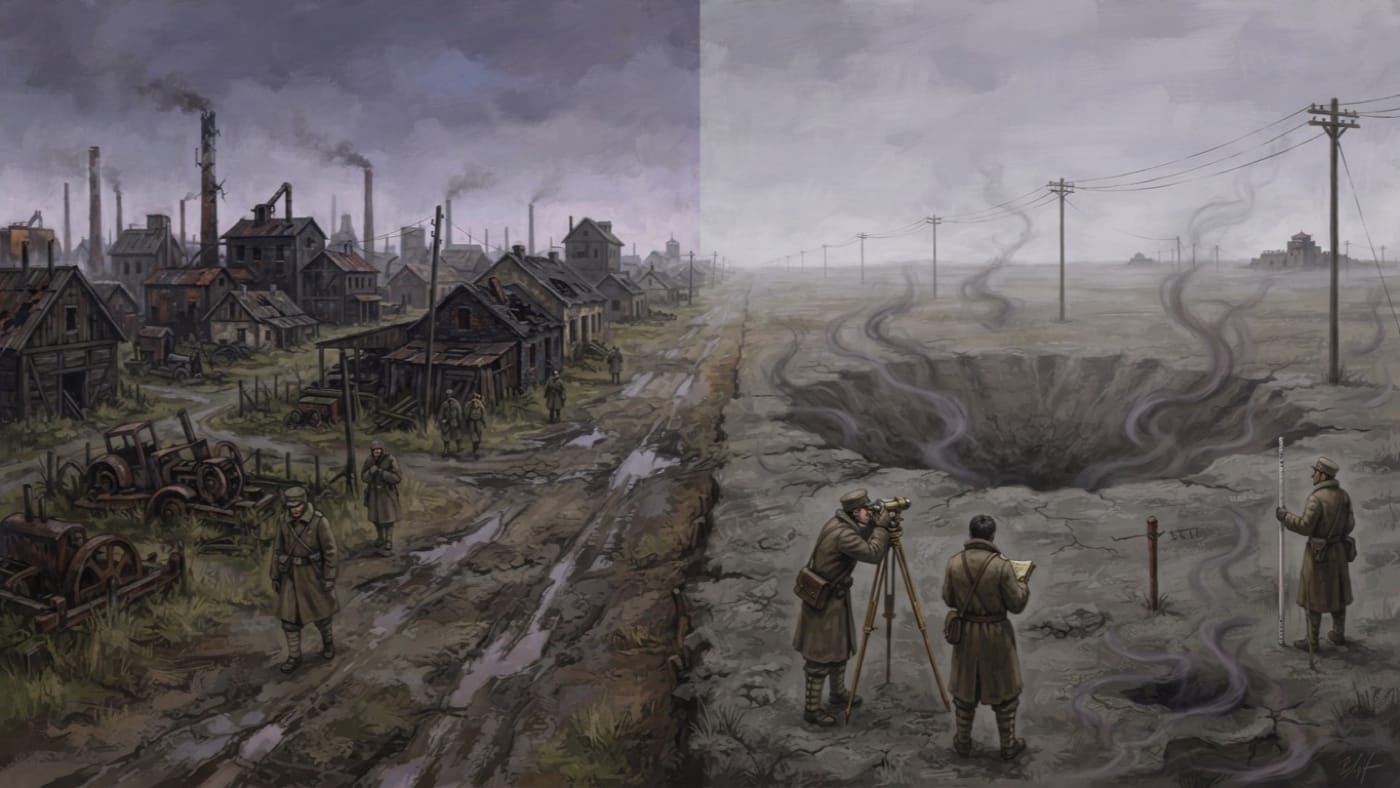
Baja is a former town. The Ledger has nothing grander to say of it, and I will not forge a charter to flatter the entry. Its name survives in the files of the eastern command for one reason: it is the nearest named place to Pit Twelve, a mass grave lying on what was once the road from Baja to Szeged. The town, the road and the grave are three separate things. Clerks who have filed them as one thing have cost me an afternoon, and I mean to break the habit here.
Everything the Codex can certify about Baja comes from two survey sheets, one dated A.S. 190 and the other A.S. 199. The two sheets differ by two hundred yards. I have read both. Neither was written by anyone who expected to be quoted, which is why I trust them more than most of what crosses my desk.
#On the Road to Szeged
The road ran across Pannonia, the old grain country, which means across the plain that Kargath took first and most thoroughly. What had been ploughland became the Blightmarsh: grey mud, grey water, and soil the agronomists describe as devoured rather than exhausted. The Marsh still advances at its edges. Famine goes ahead of it like a crier ahead of a procession, and the procession never ends.
After the Sundering the roads of this plain carried people west. The Great Retreat, which the Ledger dates from A.S. 48 to 65, emptied the eastern provinces across these flats, and the dead of that migration were put into the ground wherever the living could still lift a spade. There was no Synod then. There were refugees, soldiers, early Church chaplains, and clerks keeping lists on the backs of requisition forms. Few of those lists survive, and the ones that do say little.
The records do not say whether the dead of Pit Twelve walked this particular road, or in what year they stopped walking. I have looked. The archivists have looked. A cartographer's sheet names Baja and names Szeged because a grave has to be located by something, and a road between two towns is the last thing on that plain a surveyor can still drive a stake beside.
#On Pit Twelve
The Famine Pits are mass graves whose dead did not finish starving, and their hunger reaches into the living. A soldier who has eaten a full ration will feel his stomach clench at the edge of one. A soldier who stays will find his body burning through its own reserves as if he had eaten nothing for days. The Bureau of Medicine confirmed the phenomenon in A.S. 134. The Bureau of War holds operational jurisdiction and the Bureau of Rites contests it. Fourteen sites had been confirmed by A.S. 197, and Pit Twelve is one of them.
This is not ordinary want. A garrison short of bread is hungry. A patrol at the rim of a Pit is fed and starving at the same time, and no quartermaster's ledger has a column for that.
Of the dead themselves, the files say nothing. They record no burial count for Pit Twelve, no burial date and no names. I will not borrow the four thousand of Mohács or the eleven hundred of Szekszárd to fill the column. Those figures belong to other graves and other mourners. The column for Pit Twelve reads unknown, and I have left it that way, because a Warden of the Sacred Ledger who invents the dead to tidy a page has no business keeping the Ledger.
Doctrine files the Pits under Kargath: residual sin-manifestation, agent Gluttony. I have argued elsewhere, at length and without acknowledgement, that the hunger in those graves belongs first to the people who died in them. I repeat the objection here for the record. I do not claim to have proved it, and Doctrine has not proved its own view either.
#On the Two Assessments
The Bureau of Cartography assessed Pit Twelve in A.S. 190 and recorded an emanation radius of four hundred yards. It assessed the site again in A.S. 199 and recorded six hundred.
That is two hundred yards in nine years, a rise of half the earlier figure.
On the files as they stand, Pit Twelve is the only Pit known to have expanded since its first survey. I state that with the limit the files themselves impose. It is the only one known, among the sites someone has surveyed and then surveyed again. The eastern command suspects more graves than the fourteen it has confirmed, and nobody can say whether an unmeasured grave has grown or held still.
The figures need to be read precisely. The sheets measure how far the effect reaches. They record nothing about the grave's own size, and clerks who write of Pit Twelve "widening" as if it were a quarry face should be sent to count bricks. Two readings also do not make a rate. Between 190 and 199 the radius might have crept, or lurched, or sat at four hundred for eight years and jumped in the ninth. The sheets do not say, and I will not draw a line through two points and call it prophecy. Neither sheet states the method or threshold the Cartographers used to fix their boundary. Six hundred yards marks where their instruments, or their nerve, stopped. It is not a wall.
The Bureau of Cartography explains the change as "boundary migration consistent with Blightmarsh encroachment." The phrase has the merits of a filing category: it connects one entry to another and blames neither. It may even be correct. The Marsh does advance.
The garrison commander who received the A.S. 199 assessment is unnamed in the copy that reached me. Beneath the Bureau's explanation he wrote: "It is not migrating. It is reaching."
That makes two readings of one number. The Cartographers describe ground moving. The commander describes an appetite stretching out. Neither of them has measured an intention, and I give the verdict to neither. I note only which of them has to post sentries there.
#On the Approach
Standing Order 77-K, issued under Bastion-Constantinople Eastern Command, governs every confirmed Pit alike, and I can find no exception made for Pit Twelve. The order sets a four-mile exclusion perimeter. Patrols working within eight miles carry double rations and rotate every ninety minutes. No patrol may come within one mile without the garrison commander's written authorisation. Personnel who show unusual appetite, or who unusually refuse food, are withdrawn and quarantined under Medical Protocol 9-C.
Four miles is generous against six hundred yards, but generous is not the same as safe. The distance effects recorded elsewhere, with cramping at a few hundred yards and collapse closer in, were measured at other graves. A Warden who lays those figures over Pit Twelve like a stencil has drawn a map from hearsay. The radius on the A.S. 199 sheet is a survey line. Soldiers are not to mistake it for the edge of harm, and commanders are not to plant their stakes by it.
There is no remedy. The Bureau of Medicine has none, and the Bureau of Rites has none. The disciplines the Line keeps against Kargath elsewhere, meaning ration seals, blessings over the mess-tin and hymns against Gluttony, have had no confirmed effect on any Famine Pit, and no report I have seen suggests Pit Twelve will be the first. Distance and rotation are the only measures the Codex certifies. They keep the living back. They do nothing for the dead in the ground.
#On the Name in the Register
In the indices of the Bureau of Records, Baja appears only as a pointer to something else: "near Baja," "on the Baja road," "Baja–Szeged, Pit XII." A whole town has been reduced to a preposition.
The register knows the reach of Pit Twelve to a round figure, twice over. It does not know how many people lie in it, where they had been walking, or whether anyone in Baja watched them go into the ground. The Synod has measured the hazard twice and the dead not once. That is the order in which Bureaus count.