#On the Office That Teaches Dirt to Obey
The Bureau of Cartography is the Synod's appointed liar concerning distance.
I write that with admiration. A common liar contradicts the world for private advantage and is, if discovered, whipped by Purity or hired by Commerce according to penmanship. A cartographer contradicts the world by seal, scale, pigment, coordinate, district index, exposure table, diocesan boundary, pylon mark, river correction, burial glyph, march timing, bridge tolerance, and the little red arrow by which a general sends three thousand men toward an error with confidence. This requires training. This requires courage. This requires access to excellent paper.
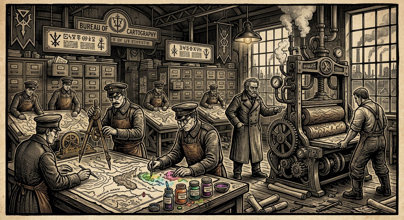
The Bureau's public title is Bureau of Cartography. Its doctrinal title, after the Second Harmonization of Administrative Geography (Unregistered), is the Office of Sacral Geography and Boundary Rectification. No one uses this title outside circulars, because men at war have limited appetite for syllables. Cartography draws maps, but this is the least of it. It decides where a bastion begins, where a parish ends, where a marsh has advanced, where a road has betrayed its previous location, where a village may be declared absent without the vulgarity of saying eaten, burned, drowned, or fiscally inconvenient.
The founding principle is simple enough for even War to understand: land belongs to the authority that can name it, mark it, tax it, defend it, and revise it before supper. The old peasant says his field reaches the oak. The priest says the diocese reaches bell audibility. Tithes says the tithe district reaches arrears. War says the forward sector reaches artillery range. Records says the province reaches the file drawer. Cartography receives all five statements, sharpens its knives, and produces a plate acceptable to three of them, tolerable to one, and fatal to the peasant.
This is government. The schoolchildren are told governance begins with law; the older clerks know better. It begins with the mark that tells law where to stand.
The Bureau's maps hang in command rooms from Strasbourg to Bastion-Constantinople, in rail offices at Warsaw, in shrine ports, in archive vaults, in Mercy depots where the poor are distributed by ward capacity, and in officers' messes where men with clean cuffs explain why a road should exist because the map has made such a handsome argument. Even taverns pin stolen copies behind barrels, because fear also likes a wall reference. They are beautiful objects: vellum, wax, coloured inks, brass bosses, sigil legends, exposure rings, sanctioned voids, interdiction hatching, and the Triune Knot stamped over any blank large enough to frighten the clergy.
They are also dangerous. A bad map kills men. A good map kills them on schedule, with witnesses.
#On Origins and the Sin of Measuring
Cartography existed before the Synod, as all useful sins did. Kings drew borders, merchants drew routes, abbots drew estates, generals drew arrows, smugglers drew coastlines that included coves no king had taxed. After the Sundering, these private arts became insufficient. The East had stopped behaving as surface. Rivers abandoned beds. Roads returned to beginnings. Marshes ate survey stakes. Villages reappeared on the wrong side of retreat. The first Line was a sequence of refusals made by exhausted men along the Masurian lakes (Unregistered), the Bug, the Carpathians, the Transylvanian wall (Unregistered), the Danube gorge (Unregistered), Shipka, and the Bosphorus. Later maps made it look intentional. Cartography was born in the correction.
In A.S. 65, the earliest Line plates were copied in field tents by officers, priests, and two professional surveyors whose names survive because one misspelled Königsberg consistently enough to be memorable. By A.S. 70, after the Council of Cologne, survey tables had been attached to episcopal record-keepers under pre-Bureau custody. By A.S. 90, under the Concordat of Strasbourg, the Cartographic Chancery received separate seal authority. The Bureau title arrived later, swollen by success and by the institutional law that no desk remains a desk once it has acquired three locked cabinets and a martyr.
Public catechisms claim the Bureau of Cartography was founded to “make known the lands entrusted to human stewardship.”
Corrected for senior circulation. The Bureau was founded because commanders kept marching into swamps, dioceses kept disputing tithe edges, and demonic territories refused to remain where frightened men had drawn them the previous week. Stewardship was added after the boots were recovered.
The philosophical quarrel came early. The Rationalists had treated maps as instruments of empirical arrogance: measure, record, revise when wrong. Primitive, but lively. The Synod treats maps as doctrinal instruments: name, bless, assign, enforce, revise with authority. A Rationalist map says the road runs here. A Synod map says the road is permitted to run here, and any road discovered elsewhere must be inspected for heresy.
The Bureau of Doctrine objected to the term cartography in the Second Harmonization, preferring sacral geography. The stamped erratum still circulates: “Cartography implies heathen empiricism. Friction is fuel.” Cartography accepted the rebuke and continued drawing maps under the old name on the useful principle that a forbidden word printed on every supply chest becomes, by repetition, authorised.
Its first great internal division produced three castes still recognised in A.S. 201: Bench Cartographers (Unregistered), who compile and falsify beautifully in offices; Field Adepts (Unregistered), who carry instruments into weather with opinions; and Mortuary Cartographers (Unregistered), who mark the dead when the ground has become too crowded for ordinary grief.
The last group deserves respect, which I grant reluctantly, like a tax exemption. They learned at the Ash-Glyph Marshworks that the war-dead can be converted into coordinates only if one accepts that coordinates sometimes move overnight.
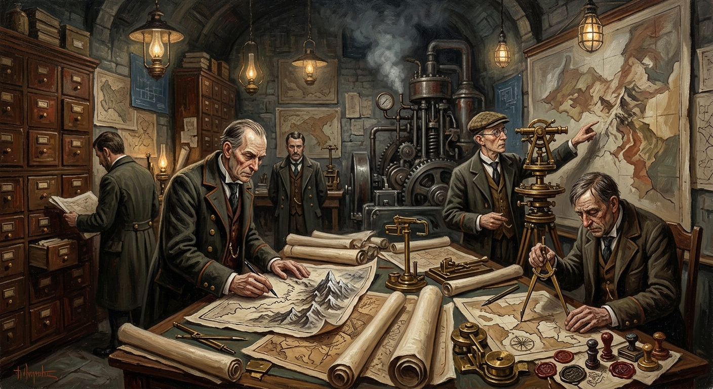
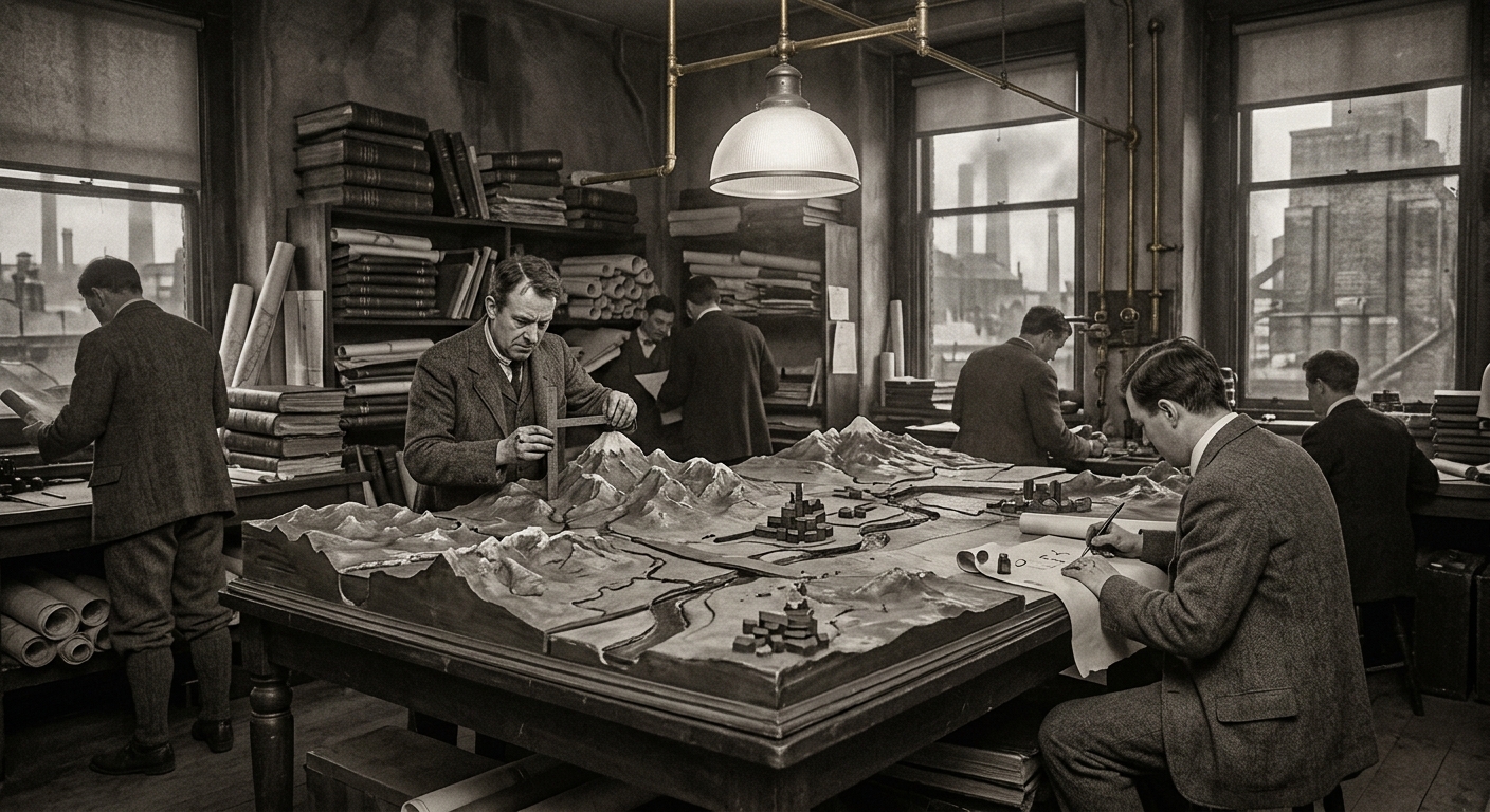
#On Instruments, Colours, and the Blessed Fraud of Scale
A Cartography field kit contains more piety than a chapel and more menace than a junior inquisitor.
The standard Adept's case includes a brass transit, two sighting rods, waxed notebooks, black and vermilion ink cakes, salt chalk, exposure wafers, diocesan string, bell-audibility cones, a collapsible prayer staff, three scale rules, one sealed blank for emergency renaming, and a pistol whose official purpose is wolf deterrence. Wolves receive little attention in eastern survey reports. Survey assistants receive more.
The Bureau's symbols descend from early Wound-Site classification. The Ash Glyph marks mass-burial grounds. The Bell-Signet marks audible zones of control. The Ledger-Rune marks tithe-gates and confession stations. Later additions include the Hunger Ring for Famine Pits, the Grey Wash for unstable demonic occupation, the Vermilion Teeth for no-recovery perimeters, the Blue Lie for rivers still printed where rivers once behaved, and the White Square, which means “blank under seal” and is the most honest symbol in the whole cabinet.
Colour is a perpetual scandal. The Charnel Lands were once tinted black in catechism maps, as if Hell's occupation were a spilled inkpot. The plate has been corrected. Black is too orderly. Kargath requires grey, yellow, bile-brown, bread-gold, and the colour of meat after the soul has gone elsewhere. Syrion requires fog grades that fade under inspection. Maldrake requires red that scorches vellum. Velmora requires gold pigment that auditors keep touching. Morwen requires duplicate colours that cannot be told apart until the beloved version walks toward you. Atheron demands height shading so arrogant that the contour lines seem to kneel. Velkara resists fixed territory and prefers routes, salons, mirrors, folded letters, and the space between a promise and the hand that signs it.
Cartography requested five new Charnel colours in A.S. 188. Tithes denied funding. The mapmakers mixed them anyway from spoiled inks, powdered brass, dried blood, and one substance the Alchemical Standards Office refused to certify because it moved toward warm fingers. The colours remain unofficial. They also remain accurate, which is why every command room uses them while pretending not to.
Scale is the Bureau's great sacrament and its great embarrassment. A scale claims that one inch means ten miles. In the Vales of Stagnance, one inch may mean ten miles in the morning, two childhoods by noon, and the same trench twice by Vespers. At the Blightmarsh, the edge advances between plate approval and plate distribution. In the Gilded Chasm, a room may be smaller than the corridor leading to it and yet contain a march of seven days. The honest solution would be to abandon scale in corrupted territory. Cartography has chosen a nobler fraud: scale remains printed, with footnotes.
Field plates now carry reliability grades. Grade A: safe for artillery. Grade B: safe for convoy in daylight. Grade C: safe for chaplains and fools, whose operational categories often overlap. Grade D: devotional fiction. Grade E: burned after reading. Grade F: burned before reading, retained in memory only by personnel willing to sign a posthumous consent form.
#On Eastern Surveys and the Arithmetic of Loss
The Bureau's finest maps have cost lives at a rate that would shame War if War possessed the organ required.
Commission 73-C remains the founding humiliation. Three hundred entered the Charnel territories to produce a general sacral geography of Zone 6. Fourteen returned with contradictory folios and the same face drawn in too many margins. The maps were burned on the 9th of Aprilis, A.S. 73. The face persisted in flame for nine heartbeats. Records filed the outcome as “Completed — No Usable Product,” a phrase so perfect that I have considered having it embroidered on the Bureau's chapel frontal.
After 73-C, general survey was abandoned in public and continued in pieces, which is how bureaucracies retreat without admitting movement. The Bureau charted the Abundance Fields six times; each map contradicted the last. The Seventh Eastern Survey in A.S. 192 produced a plate correct on the day of completion and useless by the following Tuesday. Senior Cartographer Venn (Unregistered) requested transfer to Bells, where “the things I am asked to measure at least have the decency to remain stationary.” Bells rejected him on grounds of insolence. Cartography promoted him on grounds of accuracy.
The Blightmarsh western edge has been revised seventeen times in forty years. Its A.S. 163 boundary plate projected a future line that the marsh exceeded by A.S. 178. By A.S. 190 the estimate reached nineteen thousand square miles. By A.S. 201, twenty-three thousand, expanding roughly one hundred and forty square miles per year. Cartography insists these are estimates because no surveyor has approached the eastern boundary since A.S. 185 with both sanity and return route intact.
Adept Harlen is the Bureau's favourite wound because he refuses to close. Lost in A.S. 174 during a Drava survey, declared deceased by exposure, seen again at Kestrel-11 (Unregistered) in A.S. 200, unchanged, waist-deep in the river with transit raised and face east. Three maps came back from the original survey. No agreement between them. One absence wearing his name.
Cartography has not amended the file. Harlen remains dead for fiscal purposes, sighted for operational purposes, and inconvenient for theological purposes. Records confirmed no pension liability within the hour. Rites has deferred amendment of death rites. Medicine was denied access. Doctrine instructed silence. A more complete portrait of inter-Bureau harmony could be painted only by drowning a choir in ink.
CARTOGRAPHY BENCH — HARLEN MAP C, LOWER DRAVA SHEET Notation one: “Harlen visible at second ford before loss event.” Notation two: “Harlen visible at second ford after loss event.” Notation three: “Harlen visible at ███████████████████.” Ink: same hand, same day, same pen. Disposition: retain under separate seal; do not reconcile.
The Vault of Ten Thousand Keys furnished another lesson, this one in greed's architecture. Four expeditions entered the Gilded Chasm structure in A.S. 114, 147, 174, and 196. Cartography's fragments described chambers that narrowed, maps more correct than reality, corridors that rearranged behind retreating men, and doors whose count stopped mattering when the expedition leader did. The Third Expedition counted nine hundred and eleven doors before losing Inspector Venne to a ledger. He remains, by technical classification, on assignment.
A lesser Bureau would stop after such losses. Cartography stops, revises the legend, creates a new hazard hatching, and sends a thinner party with better boots.
#On Mortuary Cartography and the Decency of Coordinates
Mortuary Cartography began as an office joke made by men who had seen too many dead to laugh properly. It became a charter in A.S. 74 at the Ash-Glyph Marshworks, where war-dead arriving by river clogged the Danube mouth faster than chaplains could bless the mud.
The Mortuary Cartography Office (Unregistered) converts remains into filing coordinates. This sounds obscene because it is honest. A corpse unburied is a scandal. A corpse buried without coordinate is a future scandal. A corpse buried with coordinate, glyph, grid, stake, entry, audit trail, and cross-reference has at least been granted the mercy of being locatable by someone with the correct key and insufficient imagination.
Early Mortuary Cartography circulars described the office as “temporary wartime necessity pending restoration of ordinary parish burial.”
Corrected. Ordinary parish burial cannot process the Line's arithmetic. The temporary necessity has outlived three directors, six budgets, two doctrinal objections, and the innocence of everyone assigned to it.
The Glyphyard (Unregistered) at the Marshworks is a vast grid of ash-staked mud. Bone-lime stakes are driven at dawn with mallets wrapped in linen to muffle the sound, because the marsh listens and because names spoken over open water there have produced recoveries that did not belong to the speaker's century. Cartographer-Provost Lysa Vane (Unregistered) presides with immaculate gloves and maps that must be redrawn after the marsh re-sorts graves overnight. A closed grid may open. A stake may appear thirty paces east. A burial row may spell a word in a language no clerk admits knowing.
Cartography calls this subsidence when speaking to War. Vane calls it nothing. Silence, in the field, is often the only superstition with proven value.
The office's work has spread. Every major bastion now maintains mortuary overlays: known burial pits, suspected burial pits, dissolved villages, unrecovered companies, drowned roads, plague trenches, ossuary overflow winters, and post-battle terrain that crunches under boot with a sound no map legend can yet render. The Hunger Rings around the Famine Pits were first drafted by Mortuary Cartographers. Pit Twelve's expanding emanation radius forced the invention of a soft-edged symbol, a thing cartographers hate because it admits the boundary is not waiting for their line.
Mortuary Cartography is where the Bureau's vanity thins into service. The dead do not care whether a plate is elegant. They care, if any care remains to them, whether their names have been placed somewhere the living may find. I dislike praising a Bureau division in print. It encourages budget requests. Yet the Glyphyard clerks perform a ministry the rest of us lack the stomach to name.
#On Inter-Bureau Quarrels and Profitable Inexactitude
Cartography survives by annoying everyone just enough to remain necessary.
War wants clear routes and artillery grids. Cartography supplies them with reliability grades, caution zones, disputed slopes, and red annotations explaining that the route exists only under weather conditions last observed in A.S. 189. War curses. War uses the map.
Records wants stable names. Cartography supplies amended place lists, obsolete village tags, duplicate hamlets, dissolved parishes, and the occasional instruction that a location be filed as devotional fiction unless three witnesses die confirming it. Records curses. Records opens a new drawer.
Doctrine wants symbolic consistency. Cartography supplies regional plates that style the same bastion as Western Anchor, Dardan Gate, or Composite Bastion according to audience, all sanctioned under Harmonization guidance. Doctrine calls contradictions edifying because Doctrine has never met a contradiction it could not baptize if given enough wax.
Tithes wants taxable area. Cartography supplies boundary contractions during famine, expansions during arrears collection, and diocese overlays that prove bell audibility at distances the peasants deny because peasants lack acoustic theology. Tithes blesses the plates and files complaints about colour cost.
Commerce wants routes. Pilgrimage wants safe roads. Shadows wants unmarked roads. Mercy wants ward catchments. Purity wants contamination boundaries. Bells wants audibility zones. Orison wants hymn carry. Engineering wants load-bearing ground. Cartography gives each a version and stamps the contradictions under appropriate compartmental seals.
Corruption would imply the existence of an uncorrupted baseline, which is a charming folk belief from villages with low literacy. It is administration under hostile metaphysics. A single plate cannot serve a supply convoy, a relic procession, a tax assessor, a plague cordon, and a demon-hunting patrol without betraying at least three. Cartography's genius lies in choosing who is betrayed on which copy.
#On Training, Oaths, and the Men Who Come Back Wrong
Cartographic training begins with humility and then beats the student with instruments until humility becomes muscle.
Apprentices spend their first year copying old parish plates until their fingers cramp in the approved posture. They learn bell-radius calculation, tithe-border convention, road-grade notation, marsh hatching, contour discipline, grave-grid alignment, and the correct shade of vermilion for a route that kills one convoy in three. They are taught never to trust a straight road in Zone Five, never to trust a curved road in Syrion's territory, never to trust a road drawn by War unless an actual mule has survived it, and never to trust any blank space that looks peaceful.
The oath is administered over a sealed atlas. The candidate places two fingers on the Line, one on Strasbourg, and one on whatever home village the Bureau has allowed him to retain sentimentally. He swears to mark faithfully, revise obediently, conceal lawfully, and burn inaccuracies before they become casualties. The last clause is ceremonial in western postings and literal in the East, where an inaccurate plate may begin whispering directions at night.
Field Adepts receive the second curriculum: how to retreat while preserving notes; how to abandon a sighting rod without abandoning the assistant carrying it; how to mark a route as forbidden when forbidden is insufficiently emphatic; how to identify bread-smell as contact; how to recognise when one's shadow has begun disagreeing with bearing north; how to report a moving hill without being diagnosed as humorous. They are issued exposure clocks and taught that courage after the clock expires is usually vanity wearing boots.
Those who return wrong are handled in the Quiet Annex (Unregistered). Wrong has grades. Grade One: repeated bearings, night sweats, map-edge murmuring. Grade Two: inability to draw a known room the same way twice. Grade Three: insisting that east has become personal. Grade Four: drawing places not yet discovered and adding casualty counts in ink that dries warm. Grade Five: attempting to enter a folded map.
The families are told less. A wife receives a stipend and a phrase: occupational distortion, route fever, eastern fatigue, sacrificial service. Children are shown medals and discouraged from asking why their father now sleeps under the table because he says the ceiling has moved south. Here the Bureau's cruelty is lexical rather than intentional. Intention, in Strasbourg, is rarely needed.
Some surveyors become Bench men after one bad outing. They sit in warm galleries, scrape plates, correct juniors, and flinch whenever rain strikes high windows. Others request return to field duty with a hunger that resembles punishment. These are watched carefully. The East sometimes teaches a man to love correction because correction means he may go back and prove the line right. Such men produce excellent maps and poor widows.
#On the Present Bureau
As of A.S. 201, the Bureau of Cartography is overburdened, underbelieved, casualty-rich, pigment-poor, and indispensable.
Its central halls in Strasbourg occupy three terraced floors below the Tower of the Quill, where map drawers run on brass rails and junior clerks are forbidden to open Eastern Section cabinets alone. The Western galleries smell of vellum and lamp oil. The Northern galleries smell of salt, cold wax, and Baltic mildew. The Southern galleries smell faintly of smoke no cleaner has found. Eastern Section has no consistent smell. This is considered a warning.
The Bureau's current labour is divided between five humiliations: updating the Blightmarsh edge for the third time this year; reconciling Charnel Lands fragment intelligence after the latest patrol sketches drew the same church in two valleys; revising Abundance Field plates after AB-17 appeared within smelling distance of the observation line; maintaining the permanent interdiction boundaries around the Vault of Ten Thousand Keys despite Tithes' formal objection that the wealth remains uncatalogued; and training a new class of Field Adepts whose examination now includes a practical exercise called “Retreat Without Looking Back.” The pass rate is poor. The survivors learn quickly.
The Bureau has petitioned for more surveyors. War has offered discharged scouts. Records has offered clerks with tremors. Doctrine has offered prayers. Tithes has offered advice. The Bureau accepted the scouts, rejected the clerks, filed the prayers, and burned the advice for heat.
A cartographer leaves Strasbourg with instruments, seals, and a map that tells him where the world was when the last honest man returned. He walks east. The road bends. The marsh breathes. The hill moves. The river accepts his colleague while standing. The field smells of bread where no oven burns. He raises his transit anyway, because someone must measure the insult.
By night, in the map rooms, apprentices scrape old boundary ink from plates with knives so fine they look surgical. They erase villages no longer present, advance marsh edges, thicken red hatching, add white squares, redraw the Line, and copy the names of the dead from field tags into registers that will be misread by some future official with a clean collar. The world refuses the map. The map returns with a stronger seal.
I have mocked Cartography often and will mock it again before the ink dries, but understand this: when a commander asks where the enemy is, when a refugee asks whether home remains, when a priest asks where to carry the reliquary, when Records asks where to put the dead, when Doctrine asks how much of mankind's loss may still be called temporary, all eyes turn to the cartographer.
He dips his pen. He lies as accurately as possible.